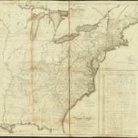
Map of the United States exhibiting the post-roads, the situations, connections & distances of the post-offices, stage roads, counties, ports of entry and delivery for foreign vessels, and the principal rivers
Dublin Core
Title
Map of the United States exhibiting the post-roads, the situations, connections & distances of the post-offices, stage roads, counties, ports of entry and delivery for foreign vessels, and the principal rivers
Creator
Abraham Bradley Junr.
Source
https://www.loc.gov/item/2004633148/
Date
1796
Type
Map
Collection
Citation
Abraham Bradley Junr., “Map of the United States exhibiting the post-roads, the situations, connections & distances of the post-offices, stage roads, counties, ports of entry and delivery for foreign vessels, and the principal rivers,” Early American History in Maps, accessed September 27, 2024, https://cornellcolab.net/EarlyAmericanMaps/items/show/122.
