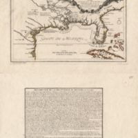
Les Costes Aux Environs de la Riviere de Misisipi
Dublin Core
Title
Les Costes Aux Environs de la Riviere de Misisipi
Subject
A map of the land around the Mississippi River claimed by France
Description
Relief shown pictorially. Shows locations of Indian villages found by La Salle during his explorations of the coastal areas of the United States. From: L'Atlas curieux / N. de Fer. Available also through the Library of Congress Web site as a raster image. Includes text entitled "Description de la Découverte du Missisipi, par N. de Fer" and ill. in title area.
Creator
Nicolas de Fer, Vincent de Ginville
Source
Library of Congress
Date
1701
Citation
Nicolas de Fer, Vincent de Ginville, “Les Costes Aux Environs de la Riviere de Misisipi,” Early American History in Maps, accessed September 27, 2024, https://cornellcolab.net/EarlyAmericanMaps/items/show/126.
