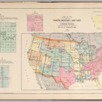
Map Showing the Principal Meridians and Base Lines in the United States Governing U.S. Surveys also Showing the Belts of Standard Time. 1895
Dublin Core
Title
Map Showing the Principal Meridians and Base Lines in the United States Governing U.S. Surveys also Showing the Belts of Standard Time. 1895
Subject
United States
Principal Meridians
Base Lines
U.S. Surveys
1895
Principal Meridians
Base Lines
U.S. Surveys
1895
Creator
North West Publishing Co.
Source
David Rumsey Map Collection
Publisher
North West Publishing Co.
Date
1895
Format
Atlas Map
Citation
North West Publishing Co., “Map Showing the Principal Meridians and Base Lines in the United States Governing U.S. Surveys also Showing the Belts of Standard Time. 1895,” Early American History in Maps, accessed September 27, 2024, https://cornellcolab.net/EarlyAmericanMaps/items/show/152.
