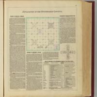
Explanation of the government surveys.
Dublin Core
Title
Explanation of the government surveys.
Subject
Unites States
Public Land Survey System
Mapping
Atlas Map
Public Land Survey System
Mapping
Atlas Map
Description
Shows subdivisions of a U.S. Public Land Survey System township, text, and table of meridians throughout the country.
Creator
Everts & Co
Source
Library of Congress
Publisher
L.H. Everts & Co.
Date
1887
Format
Text Page with Illustration, 40x32 cm
Citation
Everts & Co, “Explanation of the government surveys.,” Early American History in Maps, accessed September 27, 2024, https://cornellcolab.net/EarlyAmericanMaps/items/show/165.
