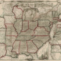
A new map for travellers through the United States of America showing the railways, canals & stage roads, with the distances
Dublin Core
Title
A new map for travellers through the United States of America showing the railways, canals & stage roads, with the distances
Subject
- Railroads--United States--Maps
- Roads--United States--Maps
- United States--Maps
- United States
- Roads--United States--Maps
- United States--Maps
- United States
Description
Prime meridian: Washington, D.C. Includes illustrations. "Entered according to act of Congress in the year 1846 by J. Calvin Smith, in the clerks office of the District Court of the Southern District of New York". Insets: Railroad & canal routes from Albany to Buffalo -- Map showing the rail roads between the cities of New York, Boston &. Albany & the Hudson R. from N. York to Albany -- Rail road route from New York to Philadelphia --Rail road route from Philadelphia to Washington -- Map of Oregon, Northern California, Santa Fé &c. Available also through the Library of Congress Web site as a raster image. LC copy signed on verso: Millard Fillmore, March 1852.
Creator
Smith, J. Calvin (John Calvin), cartographer.
Fillmore, Millard, 1800-1874, collector.
Fillmore, Millard, 1800-1874, collector.
Source
Library of Congress
Publisher
New-York : Published by Sherman & Smith, 1850.
Date
1850
Collection
Citation
Smith, J. Calvin (John Calvin), cartographer.
Fillmore, Millard, 1800-1874, collector. , “A new map for travellers through the United States of America showing the railways, canals & stage roads, with the distances,” Early American History in Maps, accessed September 25, 2024, https://cornellcolab.net/EarlyAmericanMaps/items/show/181.
