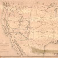
Map of routes for a Pacific railroad
Dublin Core
Title
Map of routes for a Pacific railroad
Subject
- Railroads--West (U.S.)--Maps
- Pacific railroads--Explorations and surveys--Maps
- United States--West
- Pacific railroads--Explorations and surveys--Maps
- United States--West
Description
Relief shown by hachures and spot heights. Appears in the U.S. War Dept.'s Report of the Secretary of War on the several Pacific railroad explorations, 1855. "This is a hurried compilation of all the authentic surveys and is designed to exhibit the relations of the different routes to each other. An elaborate map on scale of 1:3,000,000 is being compiled and is in an advanced state." In manuscript ink on verso: "Maps showing boundaries of proposed territory of Arizona belonging to the [illegible], Department of the Interior." Annotations in ink at lower center. LC copy imperfect: Mounted on cloth, minor discoloration horizontally along lower right half and along upper left half. Available also through the Library of Congress Web site as a raster image.
Creator
United States. War Department. Office of P. R. R. Surveys.
Source
Library of Congress
Publisher
[Washington, D.C.] : Office of P. R. R. Surveys, 1855
Contributor
Warren, G. K. (Gouverneur Kemble), 1830-1882.
United States. War Department. Office of P. R. R. Surveys.
Bien & Sterner.
United States. War Department. Office of P. R. R. Surveys.
Bien & Sterner.
Format
1 map : hand col. ; 52 x 57 cm.
Collection
Citation
United States. War Department. Office of P. R. R. Surveys. , “Map of routes for a Pacific railroad,” Early American History in Maps, accessed September 25, 2024, https://cornellcolab.net/EarlyAmericanMaps/items/show/206.
