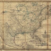
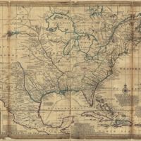
A new map of the north parts of America claimed by France under ye names of Louisiana, Mississipi [i.e. Mississippi], Canada, and New France with ye adjoining territories of England and Spain : to Thomas Bromsall, esq., this map of Louisiana, Mississipi [i.e. Mississippi] & c. is most humbly dedicated, H. Moll, geographer
Dublin Core
Title
A new map of the north parts of America claimed by France under ye names of Louisiana, Mississipi [i.e. Mississippi], Canada, and New France with ye adjoining territories of England and Spain : to Thomas Bromsall, esq., this map of Louisiana, Mississipi [i.e. Mississippi] & c. is most humbly dedicated, H. Moll, geographer
Subject
French holdings in America from English Perspective
Description
France
Mississippi
New France
Louisiana
Canada
North America
Colonial America
18th century
Mississippi
New France
Louisiana
Canada
North America
Colonial America
18th century
Creator
Herman Moll
Source
Library of Congress
Publisher
[London] : Sold by H. Moll
Date
1720
Format
.jgp
Language
English
Still Image Item Type Metadata
Original Format
map
Citation
Herman Moll, “A new map of the north parts of America claimed by France under ye names of Louisiana, Mississipi [i.e. Mississippi], Canada, and New France with ye adjoining territories of England and Spain : to Thomas Bromsall, esq., this map of Louisiana, Mississipi [i.e. Mississippi] & c. is most humbly dedicated, H. Moll, geographer,” Early American History in Maps, accessed September 27, 2024, https://cornellcolab.net/EarlyAmericanMaps/items/show/22.

